Ninety Mile Beach
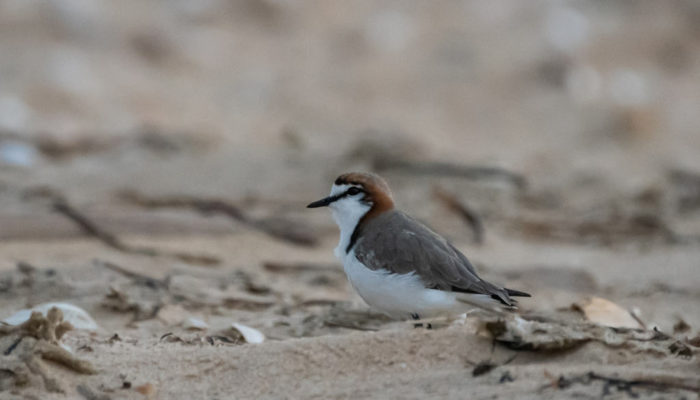
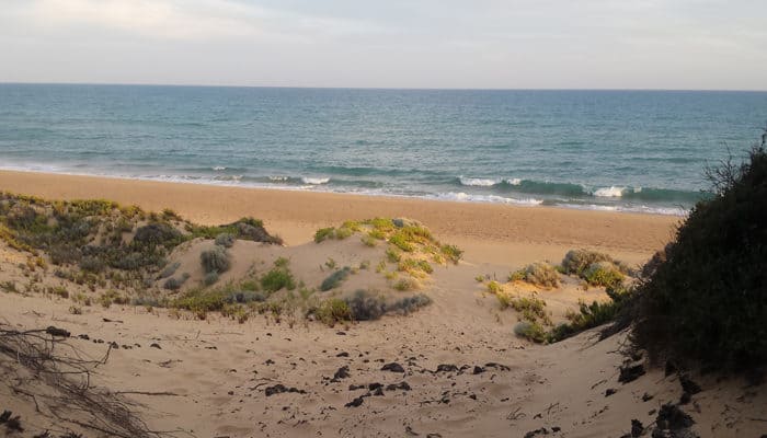
This long beach fringed by slender dunes is also the place where Victoria’s cool waters transition to the warm temperate waters of New South Wales. Ninety Mile Beach is a significant shorebird breeding habitat.
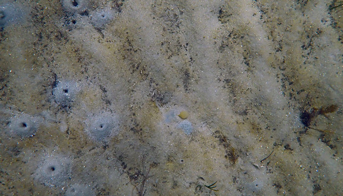
The vast, sandy underwater plains off Ninety Mile Beach have the highest species diversity found anywhere on the planet. In a survey of one area of 10 square metres, scientists discovered 860 species. This great diversity is derived from a myriad of small creatures that burrow into the sand, build tiny tubes, or scurry around eating scraps of food that may drift by. Larger animals are fewer in number, and constrained in both size and shape.
Offshore calcarenite reefs are home to resilient red seaweeds and encrusting animals such as sponges, ascidians, bryozoans, hydroids, and soft coral, which can survive the sandy environment. The unusual soft coral (Pseudogorgia godeffroyi) is only found in this area. These reefs play an important role connecting populations of reef animals from rocky areas around Wilsons Promontory with those of Victoria’s far east.
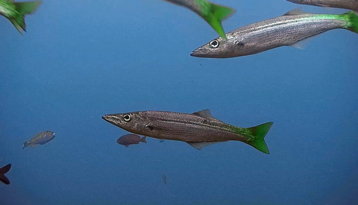
This is a productive area for fish with many species feeding on the seafloor smorgasbord of tiny animals. Schools of pelagic fish like pike, school whiting and snapper are common, and the area appears to be a nursery ground for sharks.
Marine Protected Areas
- Ninety Mile Beach Marine National Park
Gippsland Lakes
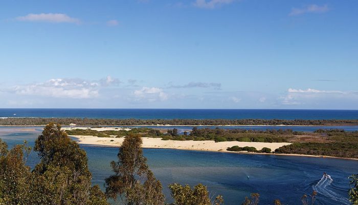
The Gippsland Lakes are a system of coastal lagoons in the southeast of Victoria. The lakes are an area of extremely high wetland bird diversity and of international significance. They are characterised by dunes, seagrasses, saltmarshes, lagoons, swamps, melaleucas and a variety of coastal vegetation, providing an important feeding, breeding and resting area for birds.
Dunes separate the lagoons from Ninety Mile Beach and the ocean. There are saltmarsh areas, deltas formed by the growth of reed swamp, melaleuca swamp areas, lagoonal and swampy areas, migrating sandy shoals and bars, and islands vegetated by sedges, reed, grasses and banksias.
The main lakes are Lake Wellington in the west, which feeds to the centrally located Lake Victoria which is connected to Lake King to the east and north. There are also many smaller lagoons with swamps and low-lying areas including Lake Reeve which runs parallel to Ninety Mile Beach.
The entrance to the lakes is through the artificially created and maintained Lakes Entrance, east of Lake King. It was cut in the foredunes in 1889 to create a shipping channel to Gippsland Lakes. The channel requires frequent dredging to maintain the opening against the deposition of sand. It is protected by a series of wooden jetties, granite walls and concrete piers. It supports important seagrass beds, as well as a segmented coastal lagoon made up mainly of shallow sand banks at Cunningham Arm.
There are five main river systems that feed the lakes. The Latrobe and Avon Rivers flow into Lake Wellington and the Mitchell, Nicholson and Tambo Rivers flow into Lake King. A mobile sand bar is located just offshore from the entrance. Water moves in and out of the entrance according to the relative levels of the lakes and sea. The lakes are subject to flooding events which can change the seabed by scouring away sand and seagrass beds. Flooding also raises the water level inside the lakes and lead to algal blooms due to an excess of nutrients in the water.
The shoreline of Lake Wellington has the largest area of freshwater swampland in Victoria. Many of the tidal deltas in this area are under threat of erosion because of dieback of reed swamp, which is likely the result of increasing salinity in the lakes. Lake Wellington is a flat-bottomed basin of organic-rich, soft mud or sandy mud. Lake Victoria and Lake King meet at the entrance to Bass Strait and have more saline environments compared to Lake Wellington. The floor of Lake Reeve, the southernmost part of Gippsland Lakes, consists of sand, shell and mud. Lake Reeve is a narrow and very shallow lagoon with extensive saline mud and sand flats.
Seagrass meadows and algae flourish in Lake Victoria and Lake King. Shallower areas of Reeve Channel also support productive seagrass meadows. Fraser Island, Flannagan Island and Rigby Island, south of Reeve Channel, have channels and shallow sand banks extending from the shores which support more areas of seagrass.
Red Bluff, near Lake Tyers is a sandstone marine cliff with lenses of pebbles, clay and gravel. The cliff has a shore platform at the base is the only naturally occurring intertidal rocky habitat in the Lakes Entrance region.
A dune-capped sand barrier formation extends for approximately 50 km from Red Bluff to Point Ricardo, east of Marlo. This dune barrier encloses a complex system of swamps and lagoons and blocks or diverts the mouth of several creeks and rivers. The dune is fronted by a narrow steeply sloped beach.
Wetland bird diversity is extremely high within the Lakes region. The area contains highly significant coastal and dune habitats. Seagrasses, Ruppia/estuarine grass and important coastal grasses and heath are all found here. Within the Lakes there are 41 species (6 flora and 35 fauna) listed under the Flora and Fauna Guarantee Act 1988.
Parts of the Gippsland Lakes system, including Lake Reeve, are listed under the Ramsar Convention on Wetlands of International Importance, especially as waterfowl habitat. The lakes attract the largest concentration of migratory waders in East Gippsland and are host to breeding colonies of the vulnerable fairy terns and little terns (Sternula nereis and S. albifrons). You may also observe common greenshank (Tringa nebularia), marsh sandpiper (Tringa stagnatilis) and bar-tailed godwit (Limosa lapponica), to name a few.
The Gippsland Lakes are also listed in both the Japan Australia Migratory Bird Agreement (JAMBA) and the China Australia Migratory Bird Agreement (CAMBA). These recognise the contribution of the Gippsland Lakes in supporting large numbers of migratory and other wetland bird species.
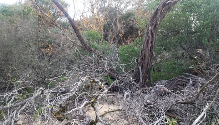
Tea-tree thickets and coast banksia woodlands grow behind the dunes. Swamp vegetation grows around the lakes and includes rushes, sedges and swamp paperbark (Melaleuca ericifolia). Heath vegetation is adapted to grow in poor soils. This includes species such as shining peppermint (Eucalyptus willisii), yertchuk (Eucalyptus consideniana), coastal tea-tree (Leptospermum laevigatum) and saw banksia (Banksia serrata). Coastal vegetation growing along the seaward side of the dunes is adapted to grow in harsh conditions of wind, salt, sun, shifting sand, little water and few nutrients. These plants include hairy spinifex (Spinifex sericeus), marram grass (Ammophila arenaria), cushion bush (Leucophyta brownii), coast saltbush (Atriplex cinerea), sea rocket (Cakile maritima maritima) and coastal everlasting (Ozothamnus turbinatus).
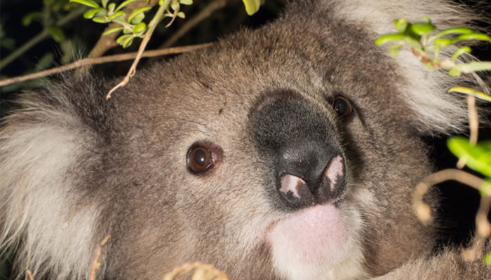
Raymond Island is located just offshore from Paynesville and divides Lakes Victoria and King. The island supports a large colony of koalas (Phascolarctos cinereus).
Marine Protected Areas
- Gippsland Lakes Ramsar Site
- Gippsland Lakes Coastal Park
Bemm Reef
The area around Bemm Reef and Point Hicks in East Gippsland contains some of Victoria’s most interesting and beautiful reefs. These underwater crags are known for their stunning sea-life.
The landscape of the area includes the prominent Point Hicks, with highly exposed shores and steeply sloping intertidal shores, flat reef, ridges, bommies, gutters and sand gutters, high wave action and kelp beds. These natural environments support a truly sensational variety of sea creatures.
Southern Australia’s waters hold the greatest diversity of large brown kelps anywhere in the world. The area’s rich marine life makes snorkelling and scuba diving a popular pursuit in the region.
The Bemm Reef area is a hotspot for biological productivity. This is due to cold water upwellings that frequently occur during summer along the coast between Lakes Entrance and Gabo Island, which changes the temperature from 20-23 °C to 14-15 °C. This introduces considerable nutrients to coastal water and draw water from below 100 m depth up the canyons, resulting in the region being a hotspot of biological productivity. Bemm Reef is home to significant filter-feeding communities and supports a great diversity of seaweeds.
Besides subtidal reef, the environment around Bemm Reef and Point Hicks includes attractive intertidal rock platforms, and offshore sands. The seafloor drops away rapidly from shore, descending to approximately 90 m depth, one of the deepest marine areas within Victoria.
The section of Croajingolong Coast from Point Ricardo to Rame Head consists of sandy beaches with dunes punctuated by occasional rocky points, including Cape Conran, Pearl Point and Point Hicks. There are outlets to streams and creeks along each of these beaches, with beach barriers creating a number of estuarine lagoons. The larger lagoons and inlets include Sydenham Inlet (Bemm River) and Tamboon Inlet (Cann River).
Point Hicks is a prominent headland with highly exposed shores on the south and east. The intertidal shore at Point Hicks slopes steeply away from shore and is dissected with gutters and gulches. The subtidal reefs are very exposed, and important kelp beds are found here as well. Here there is high biomass and diversity of thallose red algae understorey species, which can also form turfs where there is a break in the kelp canopy. The high wave action is made more turbulent by bommies and offshore barrier reefs. The front reefs and Whaleback Rock have high relief gutters and a large area of colourful, sedentary invertebrate habitat on the vertical walls. Wingan Inlet and The Skerries, a group of low reefs immediately offshore, are of high conservation value.
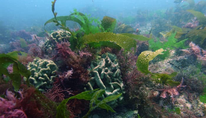
Sensation Reef (just west of Point Hicks) and reefs at Point Hicks are highly complex. These reefs have structures steep walls, bommies, pinnacles and gutters. The top of Sensation reef supports important Ecklonia kelp forests. Immediately below these swaying underwater forests, the granite slopes are home to a variety of amazing invertebrates and diverse algae, which slowly changes into sedentary invertebrate habitat deeper down.
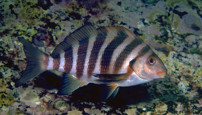
Diving around Whaleback Rock or Sensation Reef is a truly amazing experience. The water is often very clear, with sunlight glinting off schools of silver fish. As you drift down, you feel dwarfed by massive granite boulders. A forest of gently swaying brown seaweeds covers the seafloor. Below that exists a remarkable mat of colourful sponges, sea-squirts, sea-moss and sea-fans of all shapes and sizes. Many other creatures are visible between the sponges, under rocks, and poking out of the seaweed holdfasts- seastars, brittle stars, abalone, fan worms, large sea shells, hermit crabs and beautiful delicate nudibranchs (sea-slugs). Fish include schools of butterfly perch (Caesioperca lepidoptera), silver sweep (Scorpis lineolata), and longfin pike (Dinolestes lewini), and banded morwongs (Cheilodactylus spectabilis).
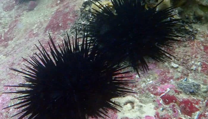
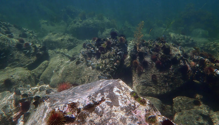
Many animals occurring here will not grow or survive in the cooler waters further west. The most obvious of these is the large black sea urchin (Centrostephanus rodgersii) that mows down the seaweeds near its shelter, creating an open environment of pink coralline-encrusted rocks.
Marine Protected Areas
- Point Hicks Marine National Park
- Beware Reef Marine Sanctuary
- Cape Conran Coastal Park
Mallacoota Inlet and Gabo Island
At the far eastern tip of Victoria is a remote wilderness that few people have seen. It is Victoria’s Pacific rim, bathed in warm water from the tropical north and buffered by waves generated in the east, a stunning feature of the coastline.
Mallacoota Inlet, with its shimmering lakes, rivers, pristine forests and turquoise sea lapping quiet beaches, is an extraordinary part of Victoria’s coast. Gabo Island is equally prominent, supporting a highly diverse range of animals, including invertebrates, fish, whales, seals and significant sea birds such as the largest known colony of Little Penguins.
Much of the coastline is formed by mobile sand dunes that are gradually shifting over the border into New South Wales. Bordering these dunes is a mixture of ancient pink granite and purple sandstone formed over 350 million years ago.
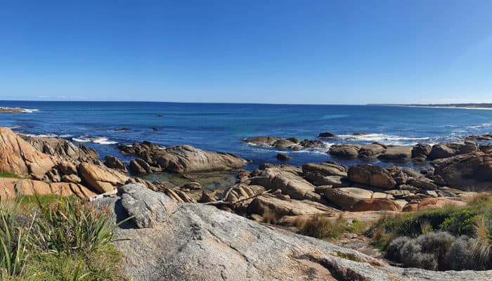
The coast around Mallacoota is made of strongly folded sandstones, shales, slates and cherts. Boulder and cobble beaches and rocky shore platforms are common in the area. Spectacular jagged shore platforms intersected by gutters and rock stacks enhance the wild feel of Victoria’s wilderness coast. Small patches of sandy beach create bars across small lagoons at the mouth of creeks.
Bastion Point is a prominent feature at Mallacoota. A low rocky reef backed by cliffs and bluffs form a somewhat sheltered cove with sandy beaches on either side of the point.
A sandy dune-covered barrier often blocks the entrance to Mallacoota Inlet, with a tidal delta just inside the entrance. This delta has sandy spits and bars, as well as islands that support important saltmarshes. A sandy beach with grassy dunes extends from the entrance to Mallacoota Inlet. Freshwater lakes, Lake Barracoota and Lake Wau Wauka occur behind the dune system. The inlet is an important feeding and roosting area for birds. It also has sandflat, saltmarsh, estuary grass, and lagoon habitats, and is of high conservation value.
Vegetation on Gabo Island is stunted by salt, wind and harsh weather conditions. Trees include tea-trees and banksia. Tussock grass in amongst the granite boulders provide nesting habitat for little penguins (Eudyptula minor) and shearwaters.
The reefs surrounding Gabo Island consist of areas of smooth, sloped bedrock, domed bommies with steep sides and boulder fields intersected with crevices. The reefs of both Gabo and Tullaberga Islands have large areas of sea urchin barrens, where long-spined urchins keep reef surfaces bare of seaweeds and inhabited instead by encrusting coralline algae. Gabo Island also has kelp habitat on the more exposed southern and eastern reefs. Patches of urchin barren habitat are also found around Cape Howe.
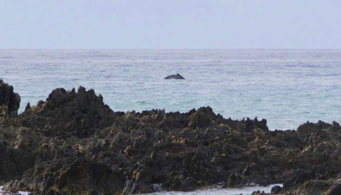
Gabo Island supports a highly diverse invertebrate community and a high diversity of fish species and is important for several listed species including the white-bellied sea-eagle (Haliaeetus leucogaster), the humpback whale (Megaptera novaeangliae) and the southern right whale (Eubalaena australis). Hundreds of humpback whales pass through the area on their annual migration between the tropics and Antarctic waters, sometimes followed by pods of orcas (Orcinus orca).
Gabo Island is home to both a penguin colony and a seabird rookery. Birds of prey also regularly visit the island from the mainland and many other sea birds can be sighted out to sea depending on the time of year. Seals are often seen in a ‘raft’ off the point from the light tower. Whales can be sighted as they migrate along the coastline during September and October.
From Telegraph Point to Cape Howe the coastline is dominated by high dunes with blowouts. The shore in this region is mostly sandy except for a small rocky outcrop near the border at Cape Howe, made up of tilted sandstone and shale. These rocks form the Iron Prince, the last reef in Victoria. A lot of the intertidal shore from Iron Prince Reef to Cape Howe is steeply sloping boulder and cobble beach. Extensive deep reef habitat occurs offshore from Iron Prince and Cape Howe. The ledges are covered in a dense forest of the brown seaweed Phyllospora that reaches over two metres in length. Beneath this thick, swirling canopy there are many smaller seaweeds, red sea-tulips, sponges, colourful seastars and large shells. Tiny brittle stars, pill bugs, and brightly coloured worms nestle around large sea squirts.
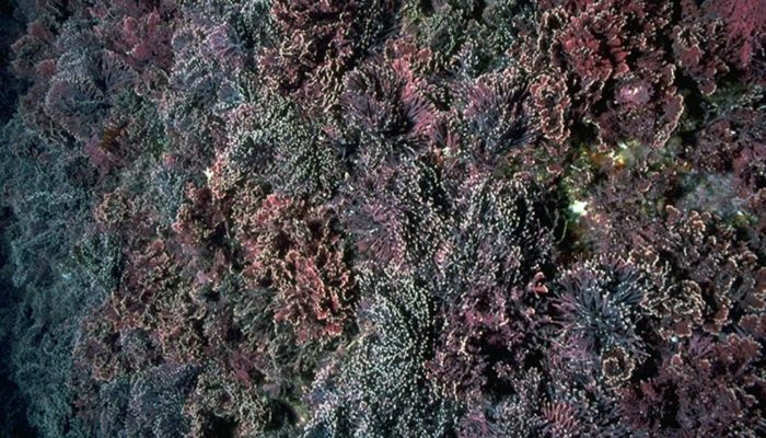
Off this section of the coast, the seafloor tilts steeply down into the deep-sea. In deeper water, where there is not enough light for the large brown seaweeds, the low sandstone reefs are covered with small patches of leafy red seaweeds and many attached animals. Sea-whips (soft corals) are common, arching gracefully up from the seafloor. Red coralline algae grow almost flat, resembling splashes of encrusted pink paint against the rocks. These encrusting corallines compete with each other for space, each one overgrowing the other. To keep themselves clean of other growth, they frequently shed their outer coating.
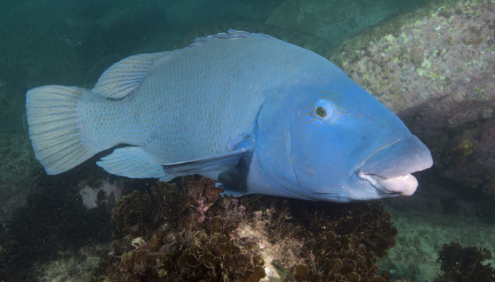
This whole region is alive with a variety of fish, with an assortment of warm and cool water species. Saddled wrasse (Notolabrus fucicola), blue throat wrasse (Notolabrus tetricus) and herring cale (Olisthops cyanomelas) dart among the kelp. Large, disk-like sunfish (Mola mola) are relatively frequent visitors, cruising slowly in the surface waters feeding on jellyfish. Other fish species you might include are the large, inquisitive, and charismatic eastern blue groper (Achoerodus viridis); the black sea urchin (Centrostephanus rodgersii); and coralline algae (Amphiroa anceps), with areas of reef at Cape Howe covered with patches of the small, upright, pink coralline seaweed like miniature forests.
Marine Protected Areas
- Cape Howe Marine National Park
- Gabo Island Lighthouse Reserve


