Striking the balance for nature, culture and recreation
Rising abruptly from the once-forested earth around it, Dyurrite (Mount Arapiles) is striking, and spectacular. The rock formation is part of the Mount Arapiles-Tooan State Park and the Dyurrite Cultural Landscape, a place rich in First Nations heritage.
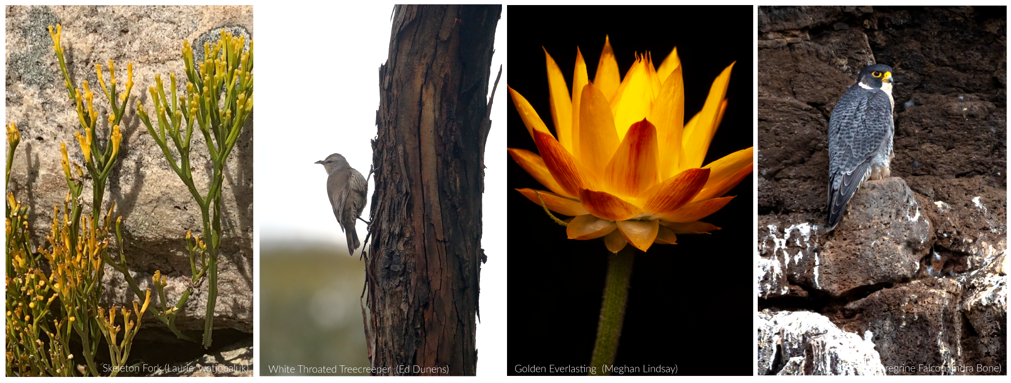
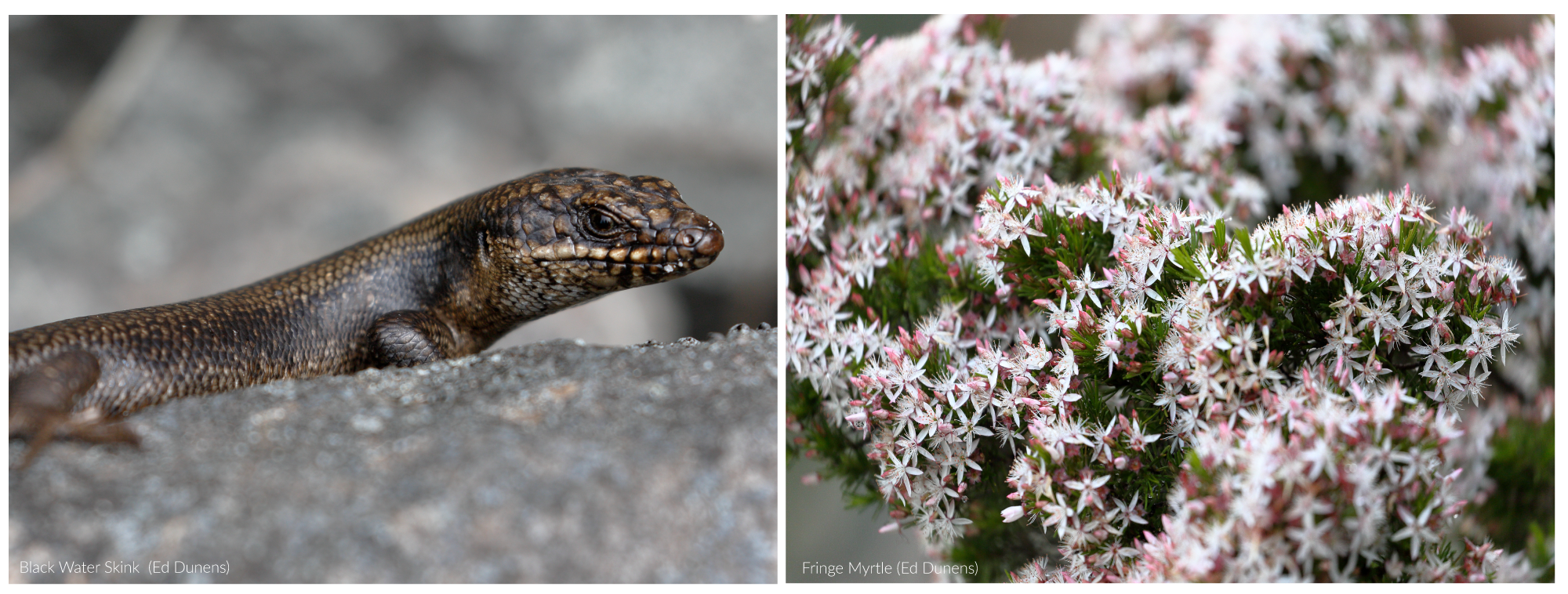
Peregrine Falcons nest high on rocky ledges. Skeleton Fork Ferns shelter in rock crevices. Black Rock Skinks scamper along sunny boulders.
Dyurrite (Mount Arapiles)also internationally renowned for rock climbing, and a place many climbers strongly identify with.
At the moment, the plan guides how this incredible place is looked after is out of date. It doesn’t reflect the presence of threatened wildlife, cultural heritage changes and progress on First Nations rights.
The Victorian Government has a new updated draft. Feedback on their new Dyurrite Cultural Landscape Management Plan closes Friday 14 February 2025.
These steps towards a more harmonious future for Dyurrite (Mount Arapiles) may challenge some people, as access will change. The new plan is a rare an important chance to strike the balance for nature, cultural heritage and recreation.
Tips for taking the survey
It’s a short survey with eight open fields and a few multichoice questions. We’ve made a list of would make the plan better for nature, First Peoples and visitors that you can use for this field. You’re welcome to use these as a guide. NB: fields have a 1000 character limit. Make sure you focus on the issues that matter most to you.
Survey question: Do you have any feedback on the draft management plan amendment?
- Changes achieve a much-needed balance that protects nature and cultural heritage and retains climbing and bushwalking. Updated information about threatened wildlife needs to be included.
- The plan must update the Wildlife Management (6.2) and Notable wildlife species (6.2.2) sections to include Flora and Fauna Guarantee Act lists and records of endangered and threatened plants, animals and fungi.
- Add long-term monitoring to track recovery of threatened wildlife and the influence of the updated plan.
Survey question: How can we make information clearer about where you can rock climb i.e. maps and/or guidelines? How can we make this information more accessible?
- Improve interpretive signage to help park visitors understand the natural and cultural context of the park.
- Update Parks Victoria website to include: Park Notes, management plans, park regulations, reasons for regulations and the special and unique nature and culture the park protects.
- Guided walks by ecologists, Park Rangers and (where appropriate) First Nations representatives, anthropologists, park users and the local community to connect with the park and better understand changes to park management.
- Improve communication about the short walks people can do in the park and surrounding reserves.
Survey question: Do you have any suggestions about updates we can make to signs and available information in the park?
- Add in the local and regional context of the Wimmera’s native plants, highlighted by VEAC (2010): ‘The Wimmera is one of the state’s largest bioregions and the second most heavily cleared. A small proportion (16.9%) of the original extent of native vegetation remains in the fragmented landscape. A very small proportion of the bioregion is represented in the conservation reserve system (1.5%).’
- Signage telling visitors about the plants, animals and fungi living in the park (including threatened wildlife), and why the park is essential to their survival.
Survey question: Do you have any suggestions about what more we can do to promote clean rock climbing techniques (example: use of chalk)?
- Please add more information about low-impact bushwalking, rock climbing and camping, and the benefits of reducing any use of chalk.
Survey question: What other information would you be interested to know about Dyurrite?
- Update Parks Victoria’s website to include: park notes, management plans, park regulations, reasons for regulations and the special and unique nature and culture the park protects.
- Improve interpretive signage to help park visitors understand the natural and cultural context of the park and surrounds.
- The regional context of vegetation communities, plants, animals and fungi that call the park home.
- Make clear maps of the short walks that people can do, both online and in the park.
- Clear information about park facilities (including toilets and picnic grounds) on Parks Victoria’s website and within the park.
Points to include in written submissions:
You can download our written submission for more information.
- The changes that protect nature and cultural heritage and retain rock climbing and bushwalking achieve a much-needed balance.
- The plan needs to update its Wildlife Management (6.2) and Notable Wildlife species (6.2.2) sections. This must include updated Flora and Fauna Guarantee Act species lists, and records of endangered and threatened wildlife.
- Long-term ecosystem monitoring to track recovery of threatened wildlife and assess the influence of the amended plan.
- Better interpretive signage in the park to give visitors insight into the natural and cultural heritage of the park.
- Improve information on the Parks Victoria website including park notes, park regulations and reasons and the values the park protects.
- Run guided walks by ecologists, Park Rangers and (where appropriate) First Nations representatives, anthropologists, park users and the local community to grow understanding of park management changes and connect people with local nature and cultural heritage.
- Improved information about short walks within the park and surrounding reserves.
- Education resources on the regional context of nature in the Wimmera, as highlighted by The Victorian Environmental Assessment Council (2010): ‘The Wimmera is one of the state’s largest bioregions and the second most heavily cleared. A small proportion (16.9%) of the original extent of native vegetation remains in the fragmented landscape. A very small proportion of the bioregion is represented in the conservation reserve system (1.5%)’.
- Signage for visitors about the plants and animals that live in the park (including threatened wildlife) and why the park is essential to their survival.
- Include information about low-impact bushwalking, rock climbing and camping ethics, and reducing the use of chalk.
- Clear information about park facilities (including toilets and picnic grounds) on Parks Victoria’s website and within the park.
Key background information
- Park management plans are more than a words on a page. They’re the blueprint of how we care for a landscape’s unique web of life. They guide recreational use and how to respect First Nations enduring connections to culture and Country.
- Dyurrite (Mount Arapiles) is renowned for rock climbing – it’s a place many climbers strongly identify with. Changes to climbing routes will be challenging for many, as access to the area will change, affecting long-held connections.
- Parks Victoria website for Mount Arapiles-Tooan State Park
- The Wotjobaluk, Jaadwa, Jadawadjali, Wergaia, and Jupagulk peoples are the Traditional Owners of Dyurrite (Mount Arapiles).
- The rediscovery of one millennia-old rock art site and one of the largest Australian Indigenous stone quarry complexes is a profound accomplishment by the Barengi Gadjin Land Council and Parks Victoria.
- The draft Dyurrite Cultural Landscape (Mount Arapiles-Tooan State Park) Management Plan Amendment reflect years of detailed survey work. These identified scar trees, cultural artefacts, ancient rock art and one of Australia’s largest Indigenous stone quarries. Ecological assessments also found threatened plants like the ancient Skeleton Fork Fern (Psilotum nudum) and Western Pellitory (Parietaria australis) that need extra protection.
- Some walking tracks will be changed or closed, and there’ll be a reduction in rock-climbing routes, including illegal routes. The changes are focussed on balancing the protection of threatened wildlife, cultural heritage and respectful recreation like bushwalking and rock climbing.
- The Victorian Traditional Owner Settlement Act and the Aboriginal Heritage Act 2006 are important pieces of legislation. They help look after cultural heritage values for generations to come.
Why get involved?
- Express support for evidence-based protection of Victoria’s natural and cultural heritage
- Learn about the issues facing our natural places and web of life
- Positively impact the decisions being made on your behalf
- Reinforce and illuminate collective concerns
Next steps: Management Plan finalised and released to the public early 2025


